Community
Stories and routes from fellow adventurers

Failing on Aconcagua: An Independent Attempt and What We'd Do Differently
Twelve days, no agency, and a summit window that never opened.
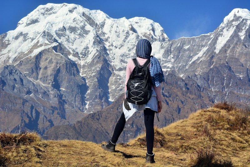
My first 6000m peak — Island Peak summit!
After 16 days of trekking and acclimatization, we summited Island Peak at dawn. The final ridge was knife-edge with massive exposure on both sides. Pemba and Mingma from Sherpa Trails were incredible — calm, experienced, and genuinely cared about our safety. Standing on top with Everest, Lhotse, and Makalu surrounding me... I'll never forget it.
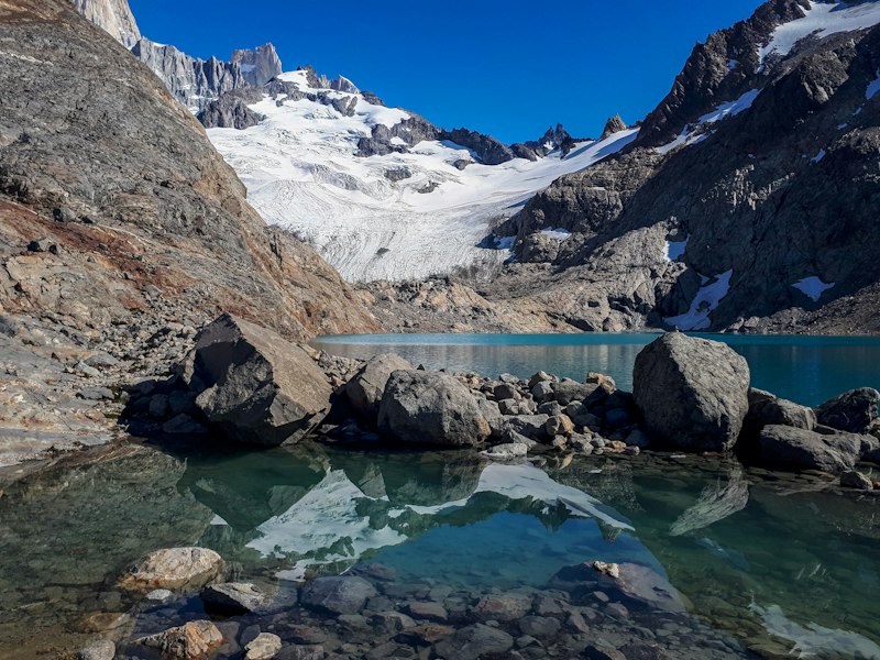
Fitz Roy at golden hour
El Chaltén is a hiker's paradise. The trail to Laguna de los Tres is demanding but the payoff is unreal — Fitz Roy's granite spires reflected in a glacial lake with chunks of ice floating on the surface. Isabella from Andean Peaks took us on an off-trail route to a viewpoint that most tourists miss. Patagonia stole my heart.
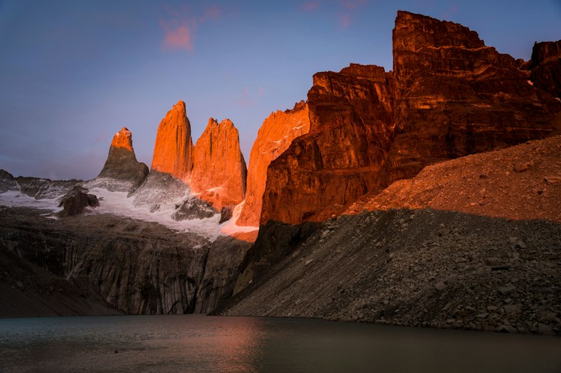
Sunrise at Torres del Paine
Woke up at 4am to catch the sunrise hitting the Torres. The granite towers turned from grey to deep orange to blazing gold in about 10 minutes. No photo does it justice but I tried! This was day 3 of the W Trek and the highlight of my entire trip to Patagonia.
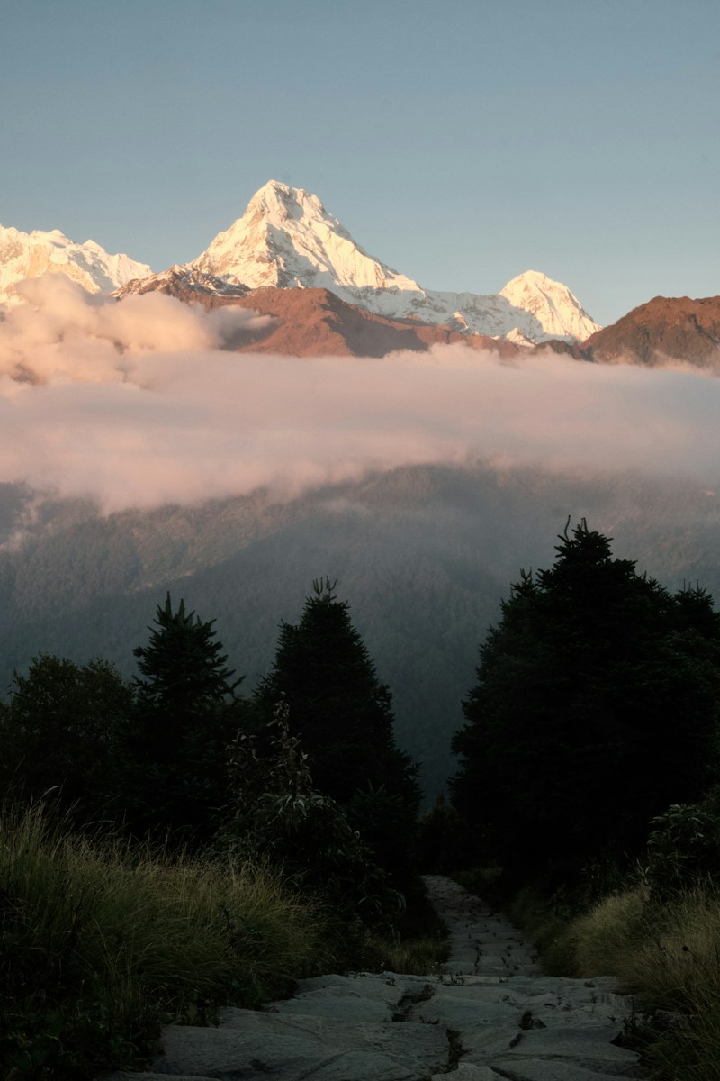
The magic of Annapurna Circuit
12 days that changed my perspective on everything. Crossing Thorong La at 5,416m was the hardest physical thing I've ever done, but the sense of accomplishment was overwhelming. Dawa was the best guide I could have asked for — she knew every wildflower by name and introduced us to families in villages along the way.
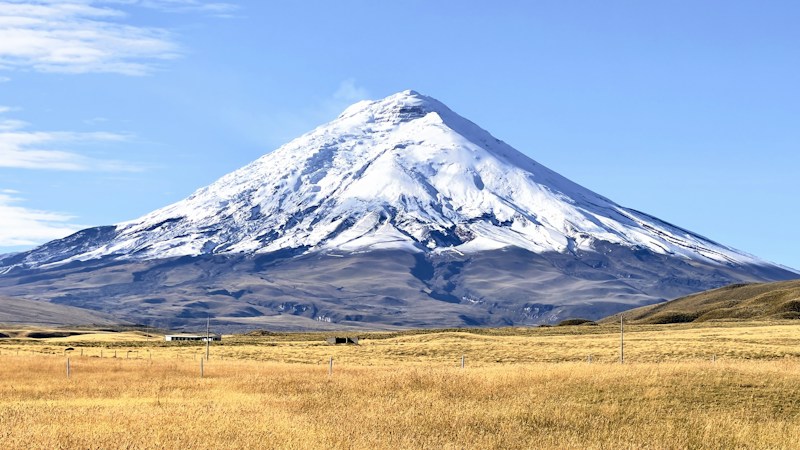
Cotopaxi midnight summit push
Started climbing at 1am under a sky full of stars. The glacier was steep and crunchy, headlamp beams dancing across the ice. Reached the crater rim just as the first light hit the Amazon basin to the east. Ecuador's volcanos are seriously underrated — highly recommend this trip as a first high-altitude experience.

The Aconcagua Failure
A week on the highest mountain outside Asia – and why we never reached the top At a glance Mountain: Aconcagua, Mendoza, Argentina. About 6,961 m – the highest peak in the Americas and outside Asia. Route: Normal Route (Horcones, north face). Not technical, but logistically complex. When: early February 2026. Duration: 8 days from the park gate to the descent. Outcome: We reached Nido de Cóndores (about 5,400–5,500 m) and never went for the summit – 85–90 km/h winds, no weather window. Official season: from 15 November to roughly late February (dates change yearly). Why Aconcagua A friend and I had already climbed a few peaks – Kazbek, Kilimanjaro, Meru and Island Peak. It felt like time to step up. But every step up costs more: price, preparation, distance, weather. We planned the trip two months out, in between reserve duty. Spoiler: it wasn't enough time. Planning: when the agencies don't play by your rules We first tried a local agency through recommendations, but the price was far above our budget – quotes were around US$5,000 and up – so we decided to go independently. Aconcagua doesn't need a close-by guide – but it does need complicated logistics. It felt to us like the agencies coordinate prices and services and want you to take the full package. We pushed and found ways to do a lot ourselves, but it was very hard logistically. Instead of mules, food, lodging, toilets and showers handled for us, we had to arrange everything: We found the person in charge of the porters at base camp and sent the heavy gear we'd only need near the summit – by helicopter straight to base camp. What we paid him also covered use of the porters' services (including the toilets). Everything else – and it was a lot – went on our backs: cooking gear, a week-plus of food, a tent rented in Mendoza, and a sleeping bag rated for the cold. 📷 Photo: gear laid out before packing / Mendoza Day 1 – Park gate to Confluencia An early bus to Aconcagua Provincial Park. We checked in with the rangers and got two bags: one for human waste, one for trash. You must carry them with you at all times. Then a gentle climb up the valley. Plenty of wind, but good weather overall. We reached the first camp, Confluencia, by evening. Elevation: start roughly 2,850 m (my estimate), Confluencia about 3,400 m. Day 2 – Acclimatization hike to Plaza Francia A beautiful, fairly steep acclimatization hike up the valley to a viewpoint on the mountain's south face: Plaza Francia. Every step is worth it. 📷 Photo: the view of the south face Day 3 – Up to base camp, Plaza de Mulas A long, exhausting and demanding day. Sleep well beforehand and start early so you can take several rest stops. You start to feel the altitude, the valley winds are strong, and the final climb to base camp is steep and surprising. It started to snow before that last climb, which made it harder still. We arrived with whatever energy we had left and rested immediately. We set up our tent – and it was clearly uncomfortable. Base camp elevation: about 4,300–4,400 m. 📷 Photo: the last climb into Plaza de Mulas / the snow Day 4 – Rest and acclimatization day A short walk around with no gear, and starting a hydration routine. Because of the uncomfortable tent we barely slept and didn't acclimatize as well as we should have. A small detail with a big effect: sleep is part of acclimatization. Day 5 – Nido de Cóndores and back Up to the first camp on the way to the summit, Nido de Cóndores, about 5,400–5,500 m, then back down to base camp to acclimatize. Day 6 – The decision: no window We spoke with the rangers and understood there was no summit window for the next week. The guideline for going up is no more than about 45 km/h of wind – and even that is very hard. The ideal is below 35 km/h. Our calmest day reached 85–90 km/h. That isn't workable. We waited two more days hoping for a change. It never came. Day 8 – Heading down On Sunday morning we decided to descend. Our time frame, the conditions, and the amount of food we'd carried wouldn't last another week. 📷 Photo: descent / last look at the mountain Lessons for anyone planning this Logistics on the mountain are fiendishly complex, and the companies control them. You can't always take just mules or pay for half a service. After what we went through, my advice: either go for the full package and give the climb everything, or skip it and find another adventure. We were disappointed, and I wouldn't recommend what we tried. Bring a flexible return ticket. The mountain decides when you get to climb it. Acclimatization and quality gear are non-negotiable. Glacier glasses (category 4), a -20°C sleeping bag, a down jacket, a Gore-Tex layer and more. Good to know before you go (checked against official sources) Permits: a summit attempt requires an Ascent Permit (up to 20 days). Shorter trekking permits exist without a summit. Prices are set in USD, paid in pesos, and vary by season and nationality (January 2024: about US$800 via a local provider, US$1,300 without). Check current prices. Insurance: required, with helicopter evacuation cover above US$5,000. Wind: on summit day gusts can exceed 100 km/h and wind chill can reach -30°C or lower. No cell coverage on the route; rangers and medical staff are at Confluencia and Plaza de Mulas. Helicopter evacuation needs a doctor's order and workable weather.

כשלון האקונקגואה
שבוע על ההר הגבוה בעולם מחוץ לאסיה – ולמה לא הגענו לפסגה במבט מהיר ההר: אקונקגואה, מנדוסה, ארגנטינה. כ-6,961 מ׳ – הפסגה הגבוהה ביותר ביבשת אמריקה ומחוץ לאסיה. המסלול: הנורמלי (Horcones, הפנים הצפוניות). לא טכני, אבל עם לוגיסטיקה מורכבת. מועד: תחילת פברואר 2026. משך: 8 ימים מהשמורה ועד הירידה. התוצאה: הגענו עד נידו דה קונדורס (כ-5,400–5,500 מ׳). לא יצאנו לפסגה – רוחות של 85–90 קמ״ש, בלי חלון מזג אוויר. עונה רשמית: מ-15 בנובמבר ועד סוף פברואר בערך. למה דווקא אקונקגואה אני וחבר כבר טיפסנו כמה פסגות – קזבק, קילימנג׳רו, מרו ואיילנד פיק. הרגשנו שהגיע הזמן לעלות מדרגה. אבל עם כל מדרגה עולים גם המחיר, ההכנות, המרחקים ומזג האוויר. תכננו את המסע חודשיים מראש, תוך כדי מילואים. ספויילר: זה לא היה מספיק זמן. ההכנות: כשהסוכנויות לא משחקות לפי הכללים שלך בהתחלה ניסינו לסגור עם סוכנות מקומית דרך המלצות, אבל המחיר היה הרבה מעל התקציב – הצעות המחיר היו באזור 5,000 דולר ויותר. החלטנו לצאת באופן עצמאי. אקונקגואה הוא לא הר שדורש מדריך צמוד – אבל הוא כן הר שדורש לוגיסטיקה מורכבת. בפועל הרגשנו שהסוכנויות מתאמות ביניהן מחירים ושירותים, ורוצות שתיקחו את החבילה המלאה. התעקשנו ומצאנו דרכים לעשות הרבה לבד, אבל זה היה קשה מאוד לוגיסטית. במקום חמורים צמודים, אוכל, לינה, שירותים ומקלחות – היינו צריכים לארגן הכול בעצמנו: מצאנו בחור שאחראי על הפורטרים בבייס קאמפ, ודרכו שלחנו את הציוד הכבד שנצטרך רק לקראת הפסגה – במסוק ישירות לבייס קאמפ. התשלום לו כלל גם שימוש בתא שירותים של הפורטרים. כל השאר – והיה המון – עלה על הגב שלנו: כלי בישול, אוכל לשבוע ויותר, אוהל שהשכרנו במנדוסה, ושק שינה מתאים לקור. יום 1 – מהשמורה לקונפלואנסיה (Confluencia) אוטובוס מוקדם בבוקר לפארק הפרובינציאלי אקונקגואה. נרשמים אצל הריינג׳רים ומקבלים שתי שקיות: אחת לצרכים ואחת לזבל. חובה לשאת אותן איתכם כל הזמן. מתחילים להלך בעלייה מתונה בתוך הוואדי. יש לא מעט רוח, אבל מזג האוויר היה טוב. הגענו לקראת ערב למחנה הראשון: קונפלואנסיה. גובה: התחלה כ-2,850 מ׳, קונפלואנסיה כ-3,400 מ׳. יום 2 – טיול התאקלמות לפלאזה פרנסיה טיול התאקלמות יפהפה במעלה הוואדי, בעלייה די תלולה, לנקודת תצפית על הצד הדרומי של ההר – פלאזה פרנסיה (Plaza Francia). הנוף וואו. יום 3 – העלייה לבייס קאמפ, פלאזה דה מולס יום ארוך, מתיש ומאתגר. כדאי לישון טוב לפניו ולצאת מוקדם כדי לעשות כמה עצירות מנוחה בדרך. מתחילים להרגיש את הגובה, הרוחות בוואדי חזקות ומקשות על ההליכה, ובסוף יש עלייה תלולה ומפתיעה עד לבייס קאמפ. אצלנו התחיל שלג לפני העלייה האחרונה, מה שהקשה עוד יותר ושאב מאיתנו את כל מה שנשאר. הגענו בשארית כוחותינו, ונכנסנו ישר למנוחה. הקמנו אוהל – והוא היה לא נוח בעליל. גובה בייס קאמפ: כ-4,300–4,400 מ׳. יום 4 – יום מנוחה והתאקלמות קצת טיולים בסביבה בלי ציוד, והתחלת משטר שתייה. בגלל האוהל הלא נוח בקושי ישנו, ולא התאקלמנו מספיק טוב. זה משפיע מאוד: שינה היא חלק מההתאקלמות. יום 5 – נידו דה קונדורס והחזרה עלייה למחנה הראשון בדרך לפסגה, נידו דה קונדורס (Nido de Cóndores), כ-5,400–5,500 מ׳, וירידה חזרה לבייס קאמפ להתאקלמות. יום 6 – החלטה: אין חלון התייעצנו עם הריינג׳רים והבנו שאין חלון לפסגה בשבוע הקרוב. ההמלצה לצאת לפסגה היא כשיש עד 45 קמ״ש רוח לכל היותר – וגם זה קשה מאוד. האידיאלי: מתחת ל-35 קמ״ש. אצלנו היום הכי רגוע הגיע ל-85–90 קמ״ש. זה לא ישים. חיכינו עוד יומיים לראות אם יהיה שינוי. לא היה. יום 8 – מחליטים לרדת בבוקר יום ראשון החלטנו לרדת. מסגרת הזמן, התנאים, וכמות האוכל שסחבנו – לא הספיקו לשבוע נוסף. מה למדתי (לקחים למי שמתכנן) לוגיסטיקה על ההר מורכבת בטירוף, והחברות שולטות בה. לא תמיד אפשר לקחת רק חמורים או לשלם על חצי שירות. אחרי מה שעברנו, ההמלצה שלי: או ללכת על החבילה המלאה ולהשקיע את כל כולך בטיפוס, או לוותר ולחפש הרפתקה אחרת. אנחנו התאכזבנו, ולדעתי לא כדאי לנסות את מה שעשינו. כרטיס חזור גמיש הוא חובה. ההר הוא זה שמחליט מתי תעלו עליו. התאקלמות וציוד איכותי הם חובה. משקפי שמש (הגנה 4), שק שינה ל-20- מעלות, מעיל פוך, שכבת גורטקס ועוד. מידע שימושי לפני שיוצאים (נבדק במקורות רשמיים) היתר: כדי לנסות פסגה צריך היתר עלייה (Ascent Permit, עד 20 יום). קיימים גם היתרי טרק קצרים בלי פסגה. מחירים נקבעים בדולרים ומשולמים בפסו, ומשתנים לפי עונה ואזרחות (בינואר 2024: כ-800$ דרך ספק מקומי, כ-1,300$ בלעדיו – בדקו מחירים עדכניים). ביטוח: חובה ביטוח שמכסה פינוי במסוק מעל 5,000$. רוח: ברום הפסגה הרוח יכולה לעבור 100 קמ״ש, ומקדם הצינה ל-30- מעלות ומטה. אין קליטה סלולרית במסלול; הריינג׳רים והצוות הרפואי נמצאים בקונפלואנסיה ובפלאזה דה מולס. פינוי במסוק דורש הוראת רופא ומזג אוויר מתאים. כל מי שרוצה לצאת למסע הזה מוזמן בחום לדבר איתי, תמיד. 0509700924